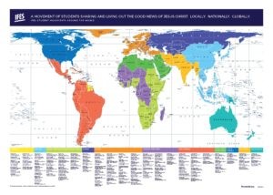
Maps are more than just guides; they are powerful tools that shape our understanding of the world. The Peters Gall Map Projection, often referred to as the Peters Projection Map, stands as a revolutionary approach to world cartography. It challenges traditional representations by presenting countries in their accurate proportions to one another, fostering a more equitable view of our planet. This map has gained significant recognition and is utilized by the United Nations, aid organizations, educational institutions, and businesses globally, marking its importance in visualizing global realities.
Unveiling the Peters Map: An Equal Area Perspective
The Peters World Map is defined as an equal area cylindrical projection. By setting standard parallels at 45 degrees, it intentionally distorts shapes, stretching areas around the equator and compressing them towards the poles. This deliberate distortion serves a critical purpose: ensuring that every country’s size is accurately represented in relation to all others. Unlike maps that distort area for the sake of shape, the Peters Projection prioritizes proportional accuracy, making it an icon for the modern concept of global equality, especially within education and business sectors.
A Historical Correction: Challenging Map Tradition
Historically, map projections, notably the Mercator projection, have misrepresented the relative sizes of countries. The Mercator projection, designed in the 16th century for nautical navigation, inadvertently inflated the size of countries at higher latitudes, such as Canada and Russia, while diminishing the visual scale of tropical regions, including Africa. Despite its navigational utility, the Mercator projection was inappropriately adopted as a standard world reference map, perpetuating a skewed perception of global proportions. While alternative projections like Robinson, Van der Grinten, and Eckert IV emerged, many still compromised on ‘equal area’ representation.
Enter the Peters map, the creation of German historian Arno Peters. This projection serves as a vital correction to the distortions inherent in traditional maps. The significance of the Peters Gall Map Projection extends beyond mere cartographic precision. It fundamentally questions and reshapes our worldview by presenting a more truthful depiction of global sizes and relationships.
Key Characteristics of the Peters Gall Map
The Peters Gall Map Projection distinguishes itself through several core characteristics, each contributing to its unique and equitable representation of the world:
Equal Area Accuracy
This map accurately portrays all areas—countries, continents, and oceans—according to their actual size. This equal area characteristic allows for genuine and unbiased comparisons between different regions, eliminating the visual distortions that previously skewed our understanding of global scale.
Equal Axis Alignment
On the Peters Gall map, all North-South lines are oriented vertically. This alignment ensures that geographic points are displayed in their correct directional relationships—northwest, northeast, southwest, or southeast—providing a more intuitive geographical understanding.
Equal Position Parallels
All East-West lines run parallel on this projection. This feature simplifies the determination of any point’s relationship to the Equator and its corresponding solar angle, enhancing the map’s utility for geographical analysis and understanding climate zones.
Fairness in Global Representation
By illustrating every country in its true size and location, the Peters Gall Map Projection acknowledges each nation’s rightful place in the world. This equitable representation is crucial in fostering a sense of global fairness and accurately portraying the geopolitical landscape.
In our increasingly interconnected and complex world, having access to the most accurate representation of each region’s global position is paramount. The Peters Gall Map Projection delivers precisely that—an essential map for our times, promoting a balanced and truthful view of the world.
To explore purchasing a Peters Map and further understand its impact, please visit our map shop on Etsy.
Beyond Peters: Exploring Other Map Projections
While the Peters Projection offers a unique and valuable perspective, we understand that different needs may call for different map styles. We offer a variety of custom map-making services, employing diverse map projections to suit various business and personal requirements. Our goal is to create maps that are not only clear and navigable but also aesthetically aligned with your brand, ensuring a positive and informative experience for your audience.
For bespoke map solutions, contact us at +44 (0)1993 705 394 or via email at [email protected].
Consider exploring our range of other map projections, including:
## Hobo Dyer Equal Area
[